Maritime places:
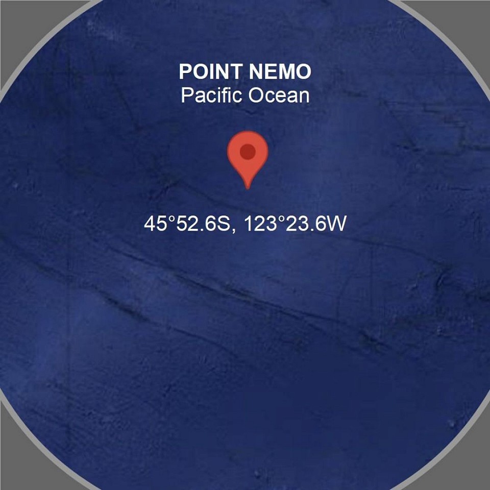
Point Nemo
Point Nemo
Point Nemo, located in the South Pacific Ocean at approximately 48°52.6′S 123°23.6′W, is the oceanic pole of inaccessibility, the farthest point from any landmass on Earth. It is over 2,688 km (1,670 miles) from the nearest land, including Ducie Island to the north, Motu Nui (Easter Island) to the northeast, and Maher Island (Antarctica) to the south. Named after Captain Nemo from Jules Verne’s Twenty Thousand Leagues Under the Sea, it was identified in 1992 by surveyor Hrvoje Lukatela. The area is known for its extreme isolation, minimal marine life due to its location in the nutrient-poor South Pacific Gyre, and its use as a “spacecraft cemetery” where defunct satellites and space debris are intentionally deorbited to minimize risk.
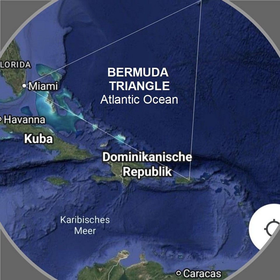
Bermuda Triangle
The Bermuda Triangle
The Bermuda Triangle, also known as the Devil's Triangle, is a loosely defined region in the western Atlantic Ocean, bounded by Miami (Florida), Bermuda (a British Overseas Territory), and San Juan (Puerto Rico), covering roughly 500,000 to 1,500,000 square miles. It is infamous for the mysterious disappearance of ships and aircraft, including notable cases like the USS Cyclops in 1918 and Flight 19 in 1945. Theories for these incidents range from natural phenomena like rogue waves, methane gas eruptions, and magnetic anomalies to human error and extreme weather, though no single explanation is universally accepted. Despite its reputation, the area is heavily trafficked, and many experts argue the number of disappearances is not statistically unusual given the region's high maritime and air traffic.
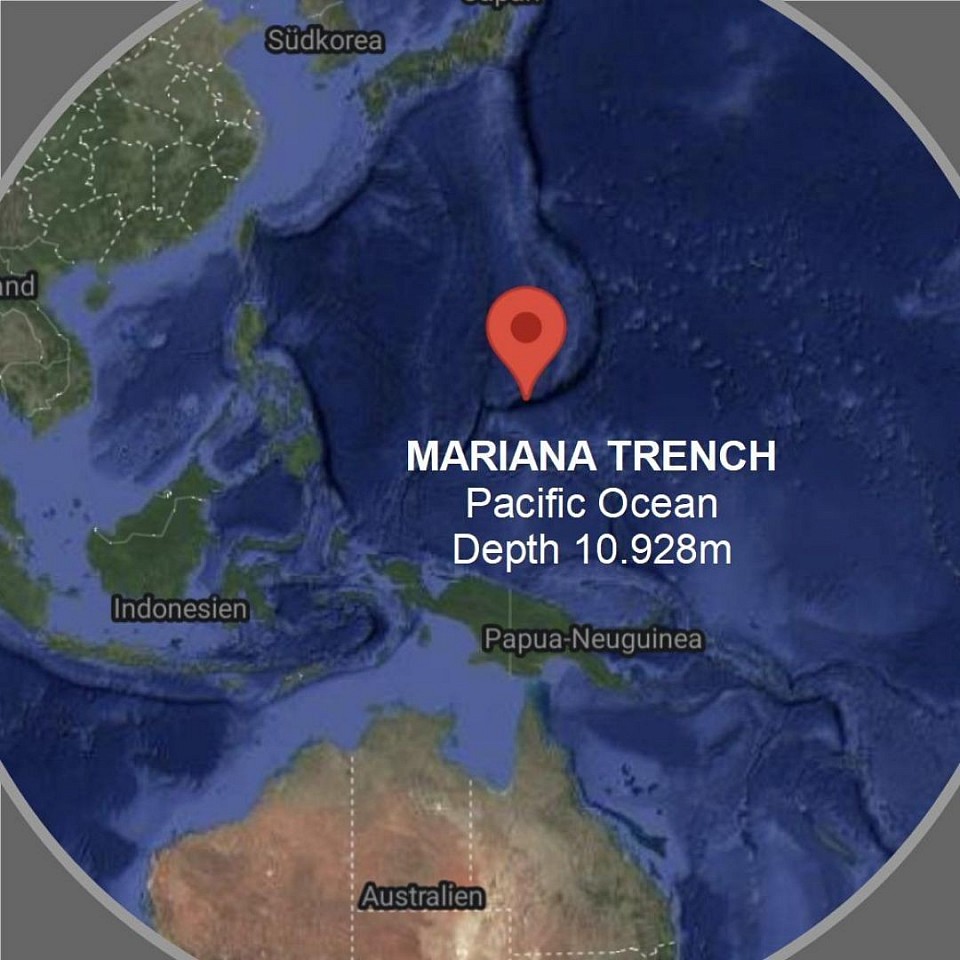
Mariana Trench
The Mariana Trench
The Mariana Trench, located in the western Pacific Ocean, is the deepest part of the world's oceans, reaching a depth of about 11,000 meters (36,000 feet) at its lowest point, known as the Challenger Deep. It is a crescent-shaped trench formed by the subduction of the Pacific Plate beneath the Mariana Plate. The trench is about 2,550 km long and 69 km wide. Its extreme depth creates a high-pressure, dark, and cold environment, hosting unique marine life adapted to these harsh conditions, such as amphipods and deep-sea fish. The trench was first explored in 1960 by the Trieste bathyscaphe, and since then, only a few manned and unmanned missions have reached its depths.
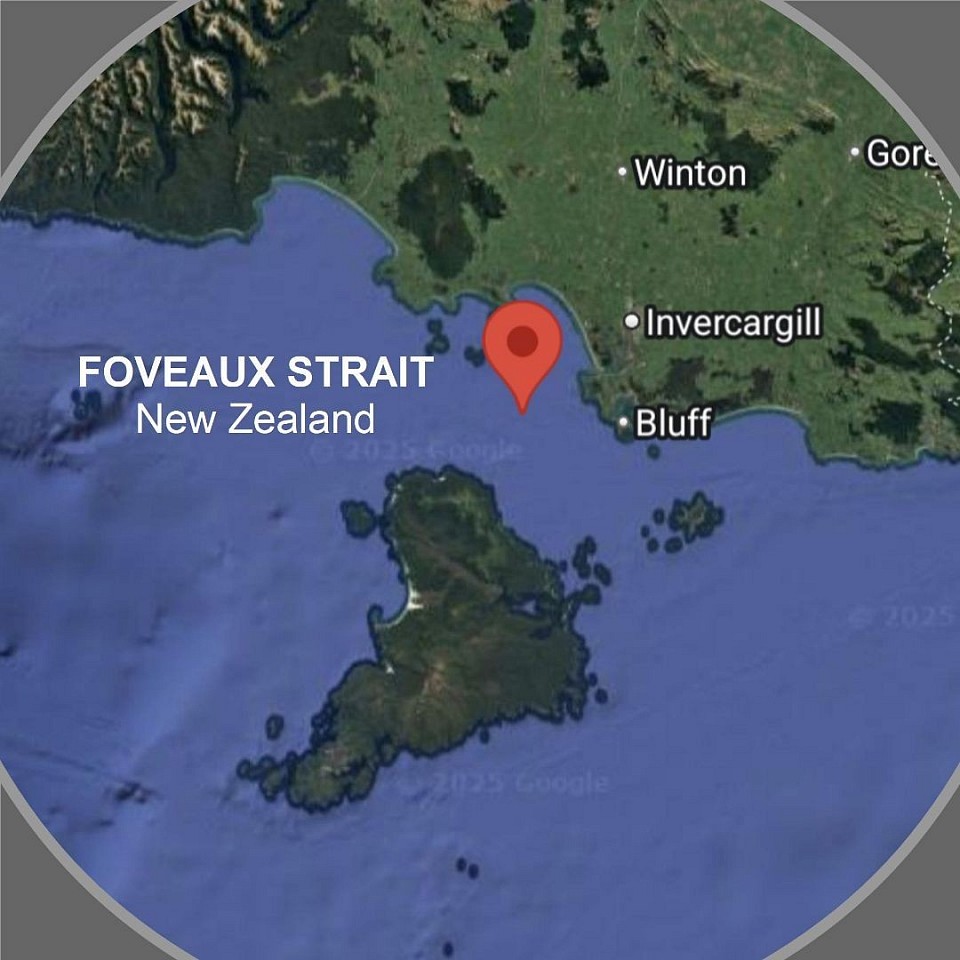
Foveaux Strait
Foveaux Strait
Foveaux Strait, located between New Zealand’s South Island and Stewart Island (Rakiura), is a 23–53 km wide seaway known for its rough and unpredictable waters due to strong winds, tidal currents, and the subtropical convergence zone. Named after Joseph Foveaux in 1809, it was first charted by Owen Folger Smith in 1804. The strait, with depths of 18–46 meters, supports a thriving Bluff oyster industry and is home to diverse marine life, including seabirds, dolphins, and fur seals. It features islands like Ruapuke and the Muttonbird Islands, where Rakiura Māori harvest sooty shearwater chicks.
The Sea Level
The term sea level refers to the average height of the sea surface, measured over a specific period to smooth out fluctuations caused by tides, waves, or weather. It serves as a reference point for elevation measurements in geography and cartography, such as specifying heights above or below sea level. Sea level can change over the long term due to climate changes, such as the melting of glaciers or the warming of oceans.
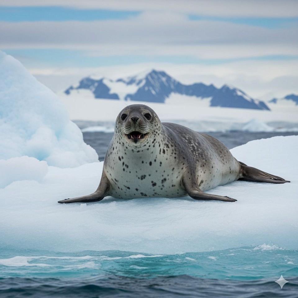
A Sea Leopard
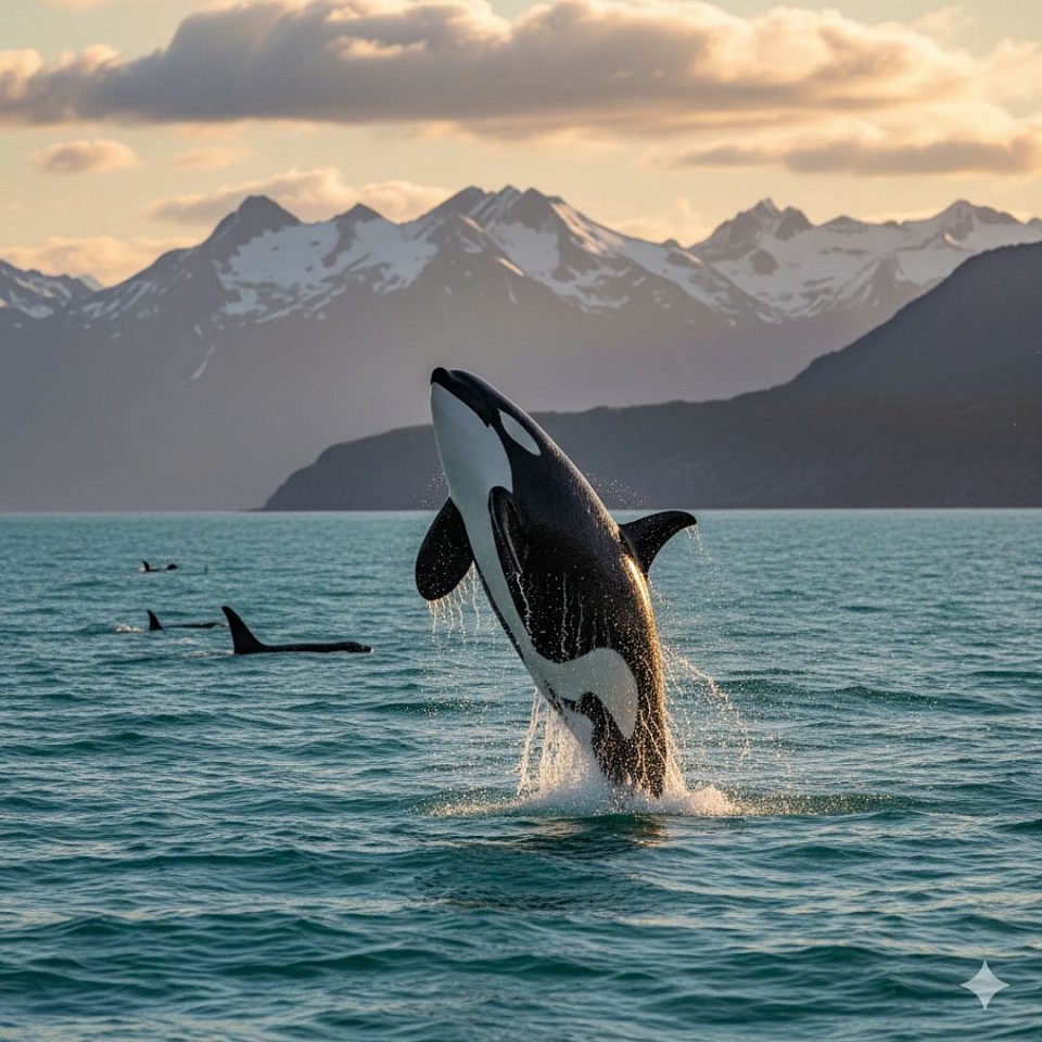
An Orca
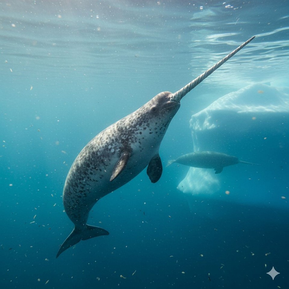
A Narwhal
The Oceans of Earth
The Pacific Ocean is the largest and deepest ocean on Earth. It covers about one-third of the planet's surface and stretches from the Arctic to the Southern Ocean. Known for the Pacific Ring of Fire with numerous volcanoes and earthquakes, it harbors enormous biodiversity and the deepest point on Earth, the Mariana Trench.
The Atlantic Ocean is the second-largest ocean and separates America from Europe and Africa. It plays a central role in the global climate system through the Gulf Stream and has historically been the most important ocean for transatlantic trade and exploration.
The Indian Ocean lies between Africa, Asia, and Australia and is the warmest of the major oceans. It is characterized by monsoon winds that influence the climate in South Asia and hosts coral reefs such as the Great Barrier Reef along its eastern boundary.
The Arctic Ocean is the smallest and shallowest ocean, located almost entirely within the Arctic Circle. It is largely covered by sea ice, which is rapidly melting due to climate change, and serves as an important indicator of global warming.
The Southern Ocean (also known as the Antarctic Ocean) surrounds Antarctica south of the 60th parallel and is the youngest officially recognized ocean. Its powerful circulation, the Antarctic Circumpolar Current, connects all other oceans and regulates the global climate through the transport of nutrients and heat.
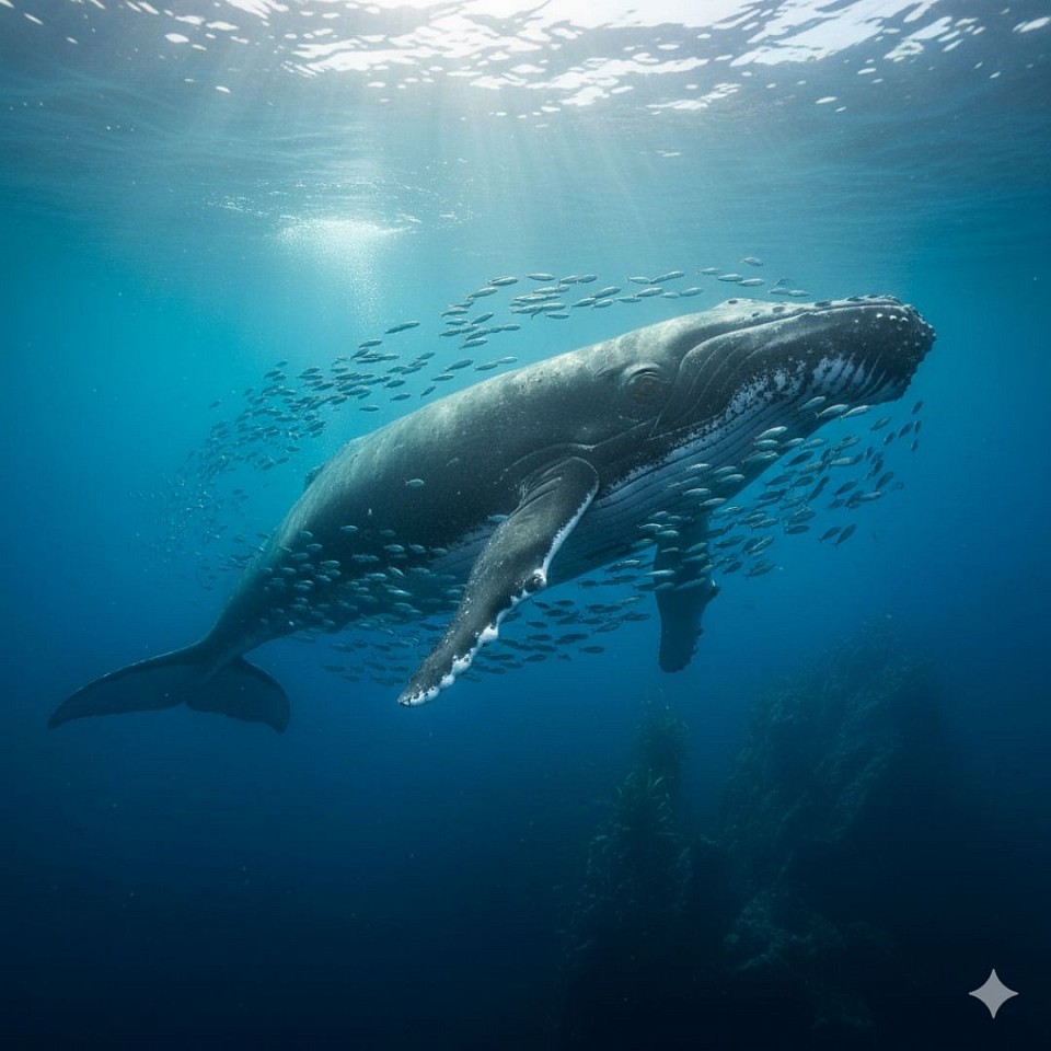
A Whale
